Zzyzx is one of the easiest places in the Mojave to visit and one of the easiest to misunderstand. It is not a ghost town and not an abandoned spa you can explore. It is an active university field station next to a small public nature trail. Here is how to visit it well.
Getting there
Take the Zzyzx Road exit from Interstate 15, southwest of Baker. Wikipedia puts the drive at 4.5 miles (7.2 kilometers) of partly paved, partly dirt road south to the settlement on the western shore of Soda Dry Lake, with Baker 7 miles north and Las Vegas about 100 miles northeast. Ordinary cars usually manage the road in dry weather, but take it slowly and check conditions after rain.
The road ends at a National Park Service parking area with picnic tables and a pit toilet. There is no drinking water, so bring your own, more than you think you need.
What's public, and what isn't
This is the most important thing to know. According to the NPS and the CSU Desert Studies Center:
- Open to visitors during daylight hours: Zzyzx Road, the NPS parking lot and picnic area, and the Lake Tuendae Trail.
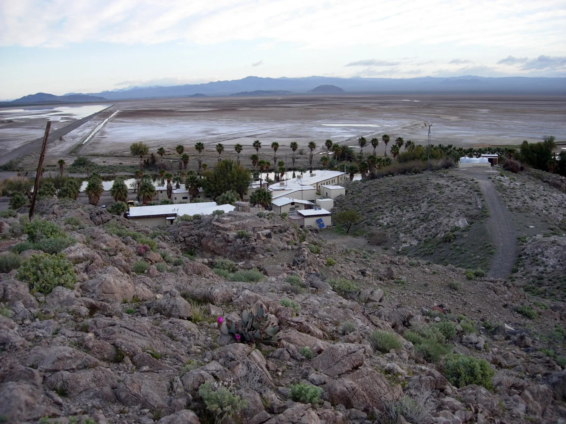
- Closed without a reservation: the grounds and buildings of the CSU Desert Studies Center next to the lake, including the old resort buildings and the pool-house ruins.
The NPS puts it plainly: "Zzyzx is not an abandoned ghost town." It says the structures beside Lake Tuendae are private property belonging to the Desert Studies Center, and that park visitors may visit only the lake and the picnic area. Students, teachers and researchers live and work there. Please respect the signs.
The Desert Studies Center also lists rules for the public area: no overnight camping or off-road driving in the lot or along Zzyzx Road, no drones or commercial photography or filming, and no pets except licensed service dogs.
The Lake Tuendae Trail
The trail is an easy, ADA-accessible quarter-mile loop around Lake Tuendae, with wayside exhibits on the natural and human history of Soda Springs. The lake is ringed with California fan palms and reeds, and on a still morning it mirrors the mountains.
Look for:
- Mohave tui chub in the water, the endangered fish that lives in the ponds. See our tui chub post.
- Birds. Permanent water is rare in the eastern Mojave, so the palms and reeds draw birds out of the surrounding desert. Bring binoculars, especially during spring and fall migration.
- Traces of the resort. From the trail you can see the old buildings and the palm-lined layout of what Springer called the "Boulevard of Dreams." Imagining guests here at the resort's peak is half the fun, and it costs nothing to stay on the public side.
The road is the property line
The National Park Service draws the boundary in one sentence: the property line is the road that separates Lake Tuendae from the Desert Studies Center campus. Everything on the campus side of that road, including the old pool-house ruins, is an active school. Teachers, researchers, and students live and work in those buildings. The ruins are not a photo set, and the Park Service asks visitors to stay with the lake and the picnic area.
The water is why birders stop. The Park Service calls Zzyzx one of the better birding spots in the area. You do not need a list of target species to make the stop worthwhile. Bring binoculars, stay on the trail, and leave the reeds alone. The endangered chub uses that cover.
Heat, water, and who to call
Zzyzx Road is partly dirt, and the preserve's safety page treats dirt-road travel as its own problem. Tell someone your route, your destination, when you expect to be back, and the make and plate of the car. Cell coverage is spotty once you leave the interstate. Carry a spare tire and a way to put air back in.
Water is the non-negotiable. The Desert Studies Center's visiting page says the Park Service lot has a pit toilet and picnic tables, and there is no drinking water on site. The preserve recommends at least one gallon per person per day while you are in the park, and two gallons per person per day if you are hiking or cycling. That is a floor, not a target for a hot afternoon. Wear sunscreen, sunglasses, and a hat. Skip hard effort in extreme heat. The same page notes snow and ice in winter, so "desert" does not mean the road is always dry and clear.
If something goes wrong, the preserve's listed contacts are practical. The Mojave National Preserve phone is (760) 252-6100, and the Park Service says to dial 911 for emergencies, including a vehicle breakdown. A 24-hour dispatch number for the preserve is (702) 293-8998. California Highway Patrol is also 911. None of that replaces telling someone you went.
When to go
The Mojave is dangerous in summer. Baker's famous roadside thermometer is 134 feet tall, a nod to the 134°F record set in Death Valley in 1913, and summer days near Zzyzx can be brutally hot. Late fall through early spring is the comfortable season. In any season, arrive early, carry water, wear sun protection and tell someone your plans.
What the gazetteer calls it
Wikipedia's entry, citing the Geographic Names Information System, lists Zzyzx as an unincorporated community in San Bernardino County, inside Mojave National Preserve, at 951 feet (290 meters). The ZIP code on that entry is 92309, and the area codes are 442 and 760. None of that means there is a town hall, a store, or a tap. It means the federal names system recognizes the settlement Springer invented. The mileage above is for planning. After rain, the dirt stretch can take longer than 4.5 miles suggests, and the preserve's safety page is the one to read before you trust a weather app.
Nearby
- Baker (about 7 miles north) has fuel, food and the World's Tallest Thermometer.
- Mojave National Preserve surrounds Zzyzx to the east and south. Its highlights include the Kelso Dunes, the Cima Dome Joshua tree forest and the historic Kelso Depot (check NPS for current hours; the depot visitor center has had closures).
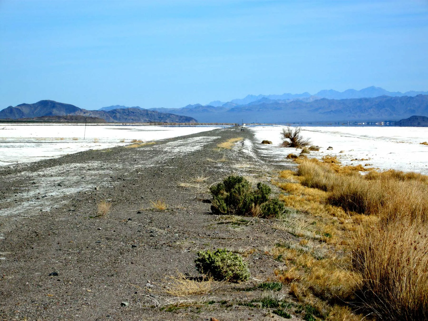
- Soda Dry Lake itself, the vast white playa beyond the lake, is where the Mojave River ends. Springer harvested its salts for his "Zy-Crystals."
Respect the place
Zzyzx has had many lives. The Mohave and Chemehuevi people used these springs for generations. It was an Army outpost in the 1860s, a railroad stop in the early 1900s, a health resort from 1944 to 1974, and since 1976 a field station. The Desert Studies Center acknowledges that it sits on the traditional and ancestral lands of the Chemehuevi people of the Southern Paiute (Nuwuvi) territory. Leave rocks, artifacts, plants and wildlife where you find them.
If you want the whole story before you go, start with how to pronounce Zzyzx and our timeline.
Sources
- National Park Service, "Lake Tuendae Nature Trail," Mojave National Preserve: www.nps.gov/moja/planyourvisit/lake-tuendae-nature-trail.htm
- National Park Service, "Zzyzx," Mojave National Preserve: www.nps.gov/moja/learn/historyculture/zzyzx.htm
- CSU Desert Studies Center, "Visiting": www.fullerton.edu/dsc/visiting/
- CSU Desert Studies Center, home page (land acknowledgment; established 1976): www.fullerton.edu/dsc/
- Zzyzx, California. Wikipedia (road length; distance to Baker and Las Vegas): en.wikipedia.org/wiki/Zzyzx,_California
- World's Tallest Thermometer. Wikipedia (134 ft; Death Valley's 1913 record): en.wikipedia.org/wiki/World%27s_Tallest_Thermometer
- Mojave National Preserve. Wikipedia (Kelso Dunes; Cima Dome; Kelso Depot): en.wikipedia.org/wiki/Mojave_National_Preserve
- National Park Service, "Safety," Mojave National Preserve (water, heat, dirt-road precautions, dispatch): www.nps.gov/moja/planyourvisit/safety.htm
- Zzyzx, California. Wikipedia (road length 4.5 miles; Baker 7 miles; Las Vegas about 100 miles; ZIP 92309): en.wikipedia.org/wiki/Zzyzx,_California
Spotted an error? Tell us and we will correct it.